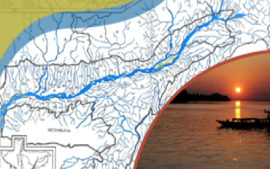
The State of Assam comprised of two valleys namely the Brahmaputra and Barak Valley and it is situated in between 90° to 96° North Latitude and 24° to 28° East Longitude. The geographical area of Assam is 78,438.00 Sq. Km out of which 56,194.00 Sq. Km and 22,244.00 Sq. Km fall under the Brahmaputra and Barak Valley including 2 (Two) hill districts respectively. The flood prone area of the state is 31,500.00 Sq Km as assessed by the Rastriya Barh Ayog which is about 39.58 % of the total land area of Assam. This is about 9.40% of total flood prone area of the whole country. The flood prone area of the country as a whole stands at about 10.2 % of the total area of the country, but flood prone area of Assam is 39.58 % of the area of the state. It signifies that the flood prone area of Assam is four times the national mark of the flood prone area of the country. Records show that average annual area affected by flood is 9.31 Lakh Hectares. The flood protected area of the state is 16500.00 Sq. Km till date.
The severity of flood problem of the state has been further aggravated by the acuteness of erosion on both banks of river Brahmaputra and its tributaries. Study reveals that an area of 4.27 Lakh Hectare of the state has been eroded by the rivers since 1950, which is 7.40 % of area of the state. The average annual rate of erosion is 8000.00 Ha. The world's largest river island Majuli is also under the grip of erosion by river Brahmaputra and about 60 % of its original area has already been engulfed by the river.
