After the unprecedented floods in the country in 1954, the Govt. of India announced a National Policy on Floods comprising three phases viz.-
The flood control activities in Assam started mainly after the announcement of National Water Policy. Subsequently, "outlined plan for flood control in Assam" along with various comprehensive plans were prepared and the priority areas, which need immediate and urgent attention were identified.
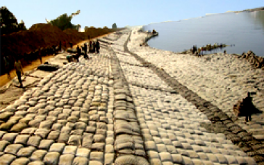
Till date, the Water Resources Department has taken up works primarily for the general development of the rural sector and for the protection of major townships in both the Brahmaputra and Barak valley. Schemes have also been taken up to relieve the drainage congestion in the cities and other important areas.
The Water Resources Department, Assam has been implementing the above mentioned flood management schemes from the beginning of 2nd Five Year Plan and is continuing till now. The up to date physical achievement is as follows:
| Length of Embankment | … | 4473.82 Km. |
| Raising & Strengthening of Embankment | … | 655.502 Km |
| Anti-Erosion and town protection works | … | 911 Nos. |
| Drainage schemes | … | 874.966 Km |
| Sluices (Major) | … | 94 Nos. |
| Sluices (Minor) | … | 545 Nos. |
No long-term measures have been implemented so far to mitigate the flood and erosion problems of the state. Till date only Immediate and short-term measures are implemented by the state Water Resources Deptt. as stated above.
Implementation of the above structures, have provided reasonable protection to about 16.50 Lakh Hectares of flood affected areas out of the total 31.05 Lakh Hectare of flood prone area as identified by the R.B.A. for the state. This flood prone area of 31.05 Lakh hectares comes to about 39.58 % of the total land area of Assam. Whereas the flood prone area of the country as a whole comes to about 10.2 % of the total area of the country, it signifies that the flood prone area of Assam is four times the national mark of the flood prone area of the country.
| Sl.No. | Name of Division | Division Wise Length (in Km.) | Name of District | District Wise Length (in Km.) |
|---|---|---|---|---|
| 1 | Dibrugarh | 364.358 | Dibrugarh | 290.508 |
| 2 | Sibsagar | 368.995 | Tinsukia | 73.85 |
| 3 | Jorhat | 238.54 | Sibsagar | 368.995 |
| 4 | Majuli | 189.214 | Jorhat | 347.254 |
| 5 | UAID, Jorhat | 55.35 | Golaghat | 133.85 |
| 6 | Dhemaji | 199.051 | Dhemaji | 199.051 |
| 7 | Dhakuakhana | 104.155 | Lakhimpur | 432.184 |
| 8 | N. Lakhimpur | 328.029 | Sonitpur | 220.328 |
| 9 | Tezpur | 220.328 | Karbi Anglong | 34.162 |
| 10 | Nagaon | 232.047 | Nagaon | 232.047 |
| 11 | Morigaon | 173.328 | Morigaon | 173.328 |
| 12 | Guwahati East | 78.14 | Kamrup (M) | 38.765 |
| 13 | Guwahati West | 216.89 | Kamrup (R) | 274.865 |
| 14 | PGP | 18.60 | Darrang | 183.138 |
| 15 | Mangaldoi | 183.138 | Udalguri | 16.00 |
| 16 | Nalbari | 229.51 | Nalbari | 229.51 |
| 17 | Baksa | 68.70 | Barpeta | 188.974 |
| 18 | Barpeta | 188.974 | Baksa | 52.70 |
| 19 | Chirang | 26.105 | Chirang | 26.105 |
| 20 | Kokrajhar | 26.611 | Bongaigaon | 25.54 |
| 21 | Dhubri | 67.13 | Kokrajhar | 26.611 |
| 22 | Goalpara | 58.10 | Dhubri | 41.59 |
| 23 | Diphu | 34.162 | Goalpara | 58.10 |
| 24 | Karimganj | 180.14 | Cachar | 474.349 |
| 25 | Silchar | 424.709 | Karimganj | 195.80 |
| 26 | Cachar Invstegation | 44.23 | Hailakandi | 128.246 |
| 27 | Hailakandi | 149.316 | N.C Hills | 0.00 |
| 28 | Haflong | 0.00 | Dima Hasao | 0.00 |
| Total | 4465.85 | Total | 4465.85 | |
The flood management works of the state are being funded from the following sources. Due to limitations of fund of its own, the state has to rely more upon the grant of the Central government. At present, the flood management activities are being carried out with the following funding –
